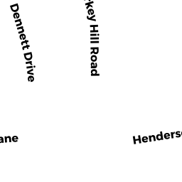
25 TURKEY HILL RD
Owner Information
MCELROY SEAN R & KRISTIE M T/E
25 TURKEY HILL RD
NEWBURYPORT, MA 01950


Property Details
25 TURKEY HILL RD is classified as a Single Family Residential (Conventional).
The primary structure on this property was built in 1909. There are 3,884ft2 of built area within this property. There is 2,368ft2 of residential/living space within this property. This property is listed as having 90 rooms.
25 TURKEY HILL RD is valued at $651,500. The land is valued at $256,500 and the structures are valued at $364,700. There is an additional valuation of $30,300 on this property.
This property is in Zone R1. Confirm with local Zoning Board authorities to ensure there are no overlays or other easements on this property.
The most recent deed for 25 TURKEY HILL RD is recorded at the local registrar in Book 36142, Page 597. 25 TURKEY HILL RD was last sold on Wednesday, August 30, 2017 for $502,000.
Assessment data from fiscal year 2021.
Flood Data
According to the FEMA National Flood Hazard Layer, this property does not appear to be in a flood zone. It may also be in an area not yet reviewed. Nonetheless, confirm this information prior to taking any action.
To view the flood hazards around this property, create a FEMA "Firmette" Map of the area around 25 TURKEY HILL RD.
Broadband Internet Providers
| Provider | Type | Bandwidth (mbps) | |
|---|---|---|---|
| Comcast | Cable | 1000 | 35 |
| Verizon New England Inc. | DSL | 5 | 0 |
| Viasat Inc | Satellite | 100 | 3 |
| GCI Communication Corp. | Satellite | 0 | 0 |
| T-Mobile | Fixed Wireless | 25 | 3 |
| VSAT Systems, LLC. | Satellite | 2 | 1 |
| HughesNet | Satellite | 25 | 3 |
Broadband service provider data from December 2020.
Adjacent Properties
- 40 BAYBERRY RD
Single Family Residential owned by WEBB KAREN - 42 BAYBERRY RD
Single Family Residential owned by MARINO JOHN F JR - 44 BAYBERRY RD
Single Family Residential owned by PANTELAKIS NICHOLAS - 48 BAYBERRY RD
Single Family Residential owned by DERRIVAN GAIL E - 46 BAYBERRY RD
Single Family Residential owned by HERNANDEZ IVAN E - 27 TURKEY HILL RD
Single Family Residential owned by NARDELLA ROBERT G - 2 HENDERSON CR
Single Family Residential owned by THALMANN TIMOTHY - 23 TURKEY HILL RD
Single Family Residential owned by PERRY JOHN M & FRANCES J TRUSTEES